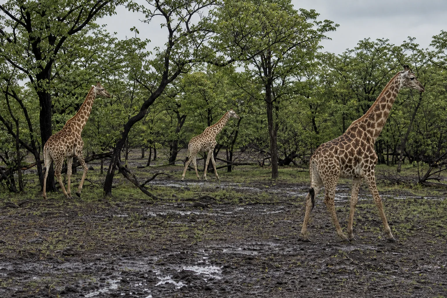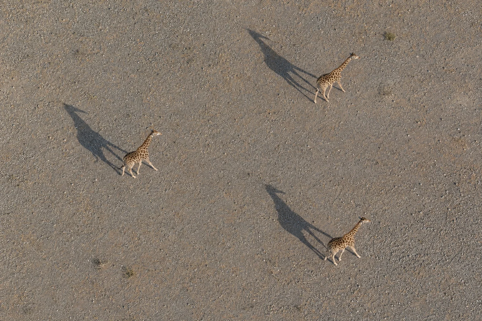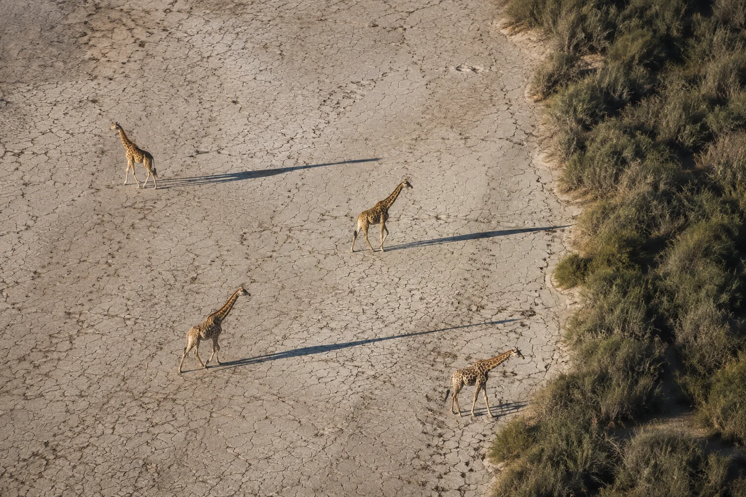
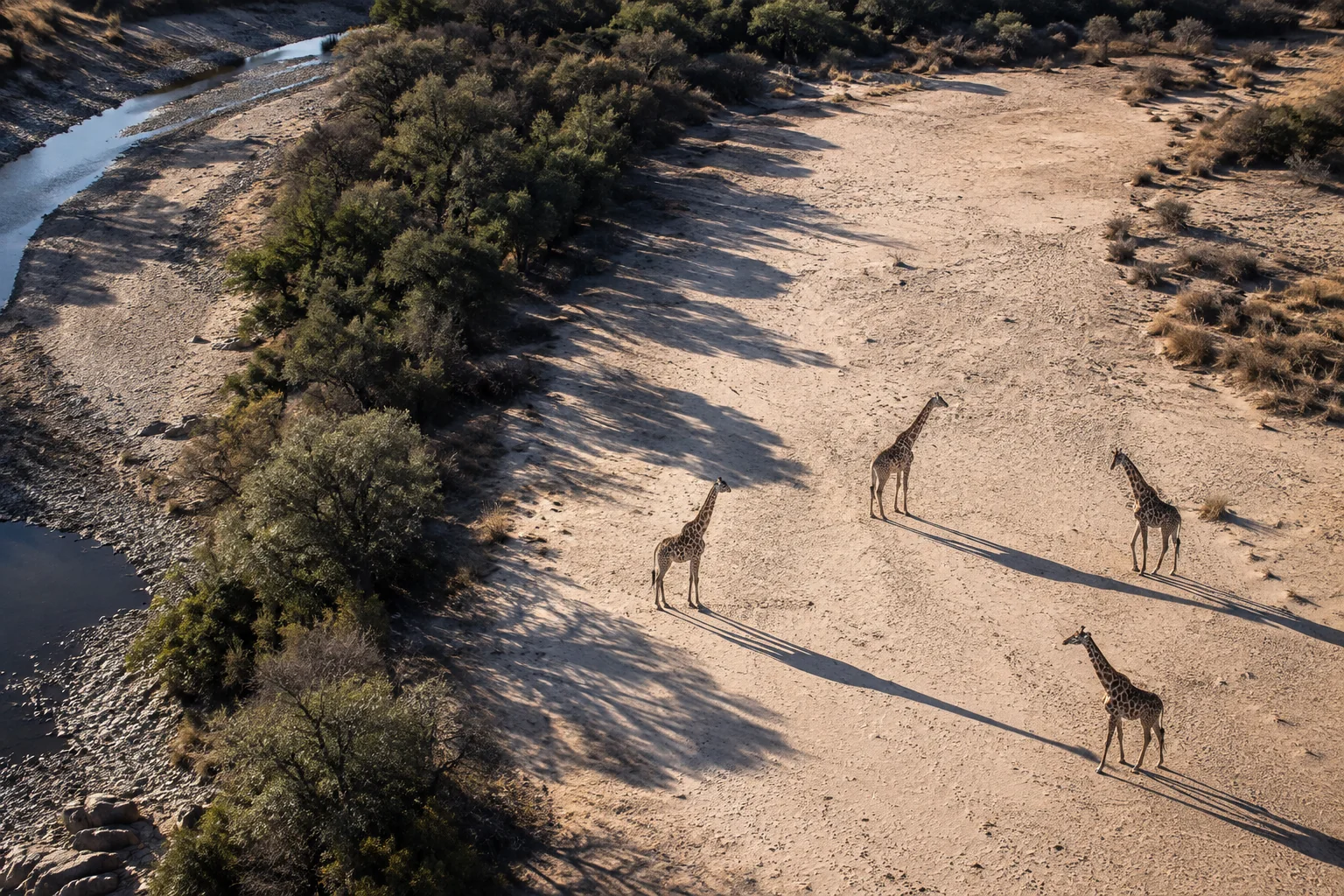
People living in the southern Luangwa Valley had been reporting giraffes beyond the limits shown on published range maps. For an animal found in only one isolated population, that gap mattered: estimates of how many giraffes remained, and decisions about which habitats needed attention, depended on where researchers looked.
A 2023 survey helped close that gap. Catherine Sun and colleagues analysed photographs from a search that extended 120 kilometres beyond the southern boundary used on an earlier range map. The team identified 55 giraffes in that southern territory and used the sightings to estimate about 150 there, including animals the survey would have missed. Their study appeared in Scientific Reports in 2025.
Across the wider study area, their estimate was 760 giraffes, excluding calves, compared with the 500–600 suggested by earlier work. The comparison becomes much more informative when the geography is taken into account: the estimate inside the previously mapped range remained broadly consistent with those older figures. Looking farther south accounted for part of the higher total. A bigger estimate alone could not establish that the population had grown.
The survey also showed how closely these Luangwa giraffes, also called Thornicroft’s giraffes, followed permanent rivers during the dry season. Their food includes the trees and shrubs growing along riverbanks and floodplains. Taken together, the findings give conservationists something more useful than a larger number: evidence of giraffes and the habitat they use beyond the population’s best-known areas.
Searching beyond the familiar range
The Luangwa Valley had a long history of giraffe observations, but uneven coverage left uncertainty around the population’s boundaries. Reports of animals farther south gave the new survey a reason to look beyond the area already shown on published maps.
Field teams followed 10 fixed routes and aimed to repeat each route on three consecutive days. Together they drove 2,919 kilometres over 1,408 kilometres of track. Some routes reached well away from permanent rivers, allowing the analysis to examine whether giraffes were concentrated near water rather than simply reflecting where observers had searched.
The resulting southern records put numbers and a defined survey area behind the earlier reports. They also gave researchers a way to include animals they had not managed to photograph. Sun and colleagues describe the survey coverage and regional estimates in the focal paper.
The photographs do not date the animals’ arrival. Local knowledge had already pointed to their presence; the team's contribution was to document it through a systematic survey and include it in a population estimate. As the habitat and range guide explains, improving a species’ map can matter even when no recent expansion has occurred.
Recognising the same giraffe twice
The fieldwork’s power came from recognising individuals. Each giraffe’s coat pattern provided a lasting visual identity, allowing photographs from different encounters to be matched through GiraffeSpotter and a Luangwa database containing sightings since 2019.
The team required a reliable match between an animal and its photographs. A left-side image could be used when it matched a known individual whose two sides were documented; otherwise an unmatched left flank risked creating a second identity for the same giraffe. Images that could not establish identity were set aside.
After exclusions, 439 encounters represented 277 individual adults and subadults. Of those animals, 112 were seen more than once. These repeats were valuable: where an animal reappears, and how often it is missed between appearances, contain information about the survey’s chance of finding it. The photo-identification guide explores this approach more broadly.
The researchers used spatial capture–recapture, a method that combines encounter histories with the location and amount of survey effort. It estimates where animals centre their activity and how the chance of seeing them falls with distance from that activity. In doing so, it can account for giraffes that lived within the study region but were never photographed.
This is how 277 identified animals supported an estimate of 760. The model's 95% credible interval, 651–890, expresses the uncertainty around that estimate. It is not a margin around a complete count. Calves were excluded because their sightings exactly followed those of adult females, which conflicted with the model’s assumption that individuals could be detected independently. The estimate therefore covers adults and subadults. Subadults have grown beyond the calf stage but are not yet adults.
The river defines the pattern
The population was spread very unevenly across the modelled 17,000-square-kilometre region. Giraffe density was highest close to permanent rivers. No giraffe detected during the survey was more than 6.2 kilometres from one, and modelled density approached zero beyond 7.5 kilometres. The paper’s density results show that river association clearly.
For a giraffe, the ecological value of a river extends beyond drinking. Riverbank woodlands and floodplain vegetation provide forage, connecting the distribution of water with the distribution of food. Sun and colleagues interpret their result as consistent with the population’s known use of these habitats. The survey did not separate the effect of drinking water from the effect of the plants growing nearby.
This is also a dry-season picture. Wet-season observations could reveal different distances from rivers, and the estimate’s outer boundary was a modelling decision informed by survey routes, aerial sightings and terrain. Some rugged northern territory lay outside it. The result is a strong account of the sampled season and region, rather than a claim that every giraffe remains within a fixed strip all year.
One conservation implication we see in the geography is that losing a stretch of suitable riverine habitat could affect a population whose usable landscape is far narrower than the valley’s total area suggests. That possibility gives researchers a reason to follow the condition and continuity of habitat as well as the population total.
What the older surveys let us compare
Philip Berry and Fred Bercovitch’s 2016 Luangwa study gives this result historical depth. Their long record, covering 1973–2003 with a further survey in 2013, found a broadly stable index of giraffes seen per kilometre. They used the 2013 observations and the extent of river-associated habitat to reason towards the 500–600 estimate. Its strength was decades of observation in a core area; the newer study adds broader coverage and a spatial detection model. Together they provide a firmer starting point for asking how the population changes next.
Derek Lee and Monica Bond’s 2016 comparison of giraffe survey methods shows why the observation method matters. Across four Tarangire sites in Tanzania, photographic capture–recapture gave more precise estimates than distance sampling or aerial surveys. Aerial estimates were significantly lower than the photographic estimates at three sites. Their numerical corrections cannot simply be imported to Zambia, but the connection is useful: individual recognition can reveal population differences hidden by uneven visibility.
Living in a shared valley
The Luangwa analysis also examined a Human Footprint Index, which combines measures of human pressure. Giraffe density initially rose with the index before falling at higher values. Sun and colleagues suggest that limited direct conflict may help explain why giraffes can use moderately altered landscapes: in Luangwa, they note, giraffes cause little crop damage. Where suitable vegetation remains, sharing the landscape with people may therefore be possible.
That finding gives land-use planning a practical question: which conditions allow giraffes to remain alongside people? It does not establish that more development improves habitat. A composite index combines several pressures, while the survey measures where animals occurred during one season.
The southern records make the question especially relevant. A population’s conservation geography may extend beyond its best-known park, into places where decisions about vegetation, access and land conversion are made by different people. Our habitat-protection guide considers that wider challenge.
What another season could tell us
Another round of observations could answer three useful questions:
- Are numbers changing within a comparable area? Repeating the dry-season survey with the same routes and age scope could estimate change within a fixed area while recording newly searched territory separately.
- Does the river association change after rain? Wet-season surveys could reveal whether giraffes spread farther into the valley when forage and water become more available.
- How many young giraffes reach the older age classes? Following known females and calves over several years could connect abundance with survival and recruitment, helping explain future changes in the total.
Because individual giraffes can be recognised again, a future survey can follow more than a total. It can ask which animals remain, where they move and whether the newly documented southern area continues to support them.
Sources
- Catherine Sun, Frederike Otten, Rigardt Hoffman, Courtney Marneweck, Howard Maimbo, Charles-Albert Petre, Dusty Joubert, Tom Riffel, Matthew S. Becker, Stephanie Fennessy, Julian Fennessy and Michael B. Brown (2025). First rangewide density estimate of the endemic and isolated Luangwa giraffe in Zambia. Scientific Reports 15, article 16435. DOI: 10.1038/s41598-025-00306-w. Published 12 May 2025. Public data and analysis-code record.
- Philip S. M. Berry and Fred B. Bercovitch (2016). Population census of Thornicroft’s giraffe Giraffa camelopardalis thornicrofti in Zambia, 1973–2003: conservation reassessment required. Oryx 50(4), 721–723. DOI: 10.1017/S003060531500126X.
- Derek E. Lee and Monica L. Bond (2016). Precision, accuracy, and costs of survey methods for giraffe Giraffa camelopardalis. Journal of Mammalogy 97(3), 940–948. DOI: 10.1093/jmammal/gyw025; author-organisation full text.