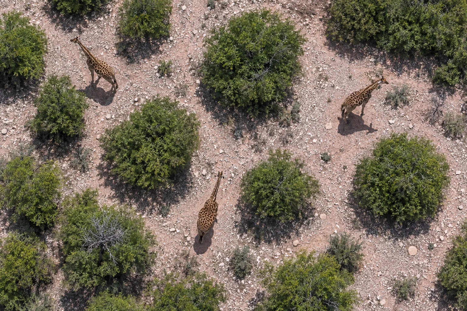
A good feeding place is only useful to a giraffe that can reach it. For a browser eating leaves, shoots and flowers, the next meal may be in another patch of woody plants. Rain changes where fresh growth is available, while steep ground, rivers and fences can limit the ways to get there. Protecting giraffe habitat therefore involves both food and access to it.
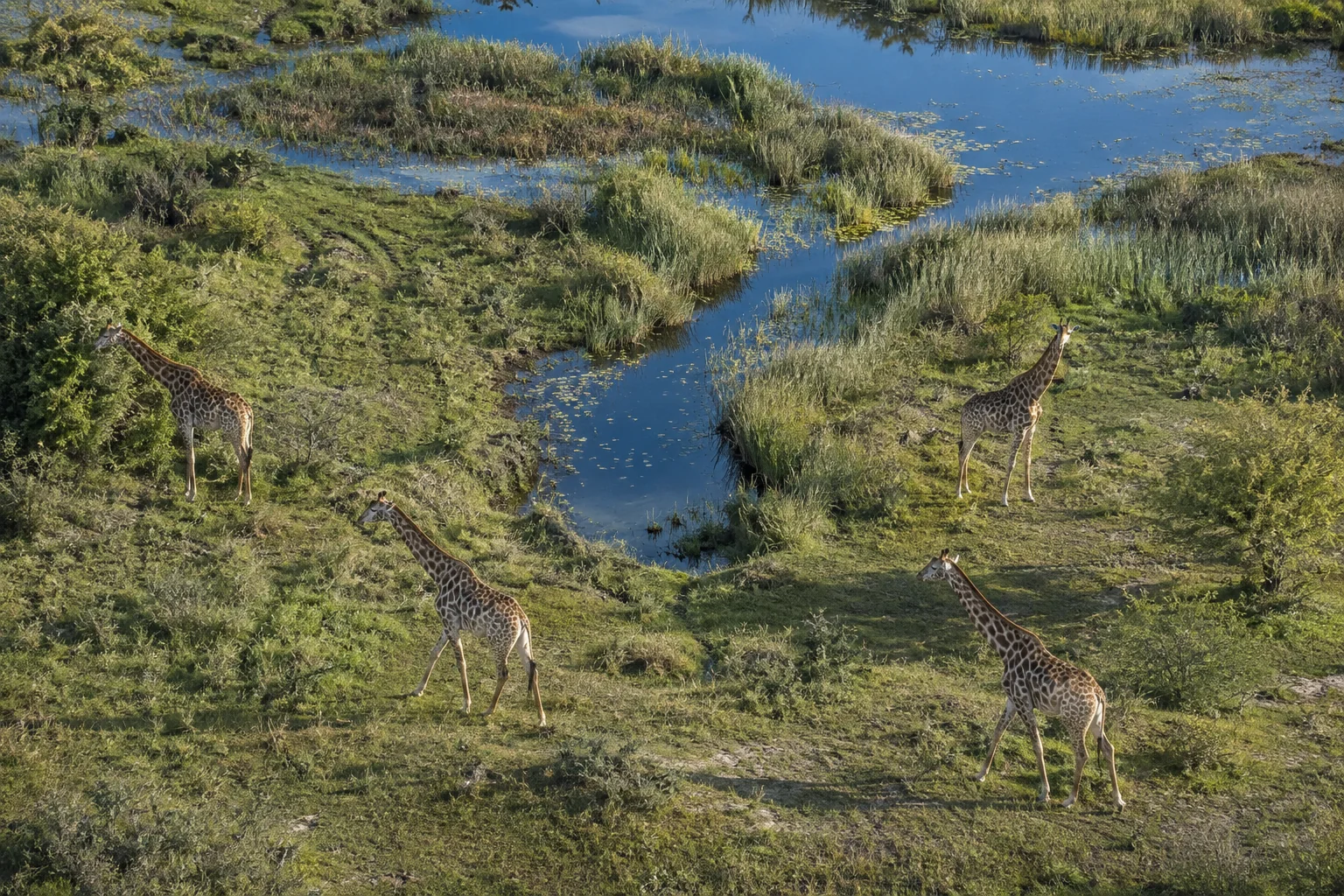
Shannon Boudreaux and colleagues investigated that connection around Loisaba and Mpala conservancies in Kenya. Their 2026 study in Landscape Ecology used the movements of 14 reticulated giraffes to ask which kinds of ground the animals chose. A detailed analysis of Loisaba revealed a preference for moderately open habitat: grassland interspersed with shrubs and trees, offering browse without continuous thicket.
The team then asked where this preferred habitat fits into the surrounding terrain. Their maps suggest that giraffes have many possible ways through much of the landscape, but fewer alternatives in some parts of Loisaba. That distinction matters when considering a new barrier: obstructing one of many possible routes and closing a passage beside difficult terrain could have very different consequences for access to food.
Comparing a journey with the alternatives
A tangle of GPS tracks shows where giraffes went. To learn whether they favoured a particular habitat, researchers also need to consider where they could have gone. A giraffe may enter a patch because it is attractive, or because almost everything within reach is the same kind of ground.
For each movement between hourly GPS positions, Boudreaux’s team generated 10 plausible alternative steps, using the distances and turns represented in the tracking records. They compared the habitat at the actual endpoint with the habitat at those alternatives. Repeated across many steps, this comparison asks whether giraffes used a habitat more often than its availability alone would suggest. The method is called integrated step selection.
The analysis used records from 2017 and 2019, selected from a longer tracking programme for their more consistent coverage. Satellite measurements of vegetation greenness separated wet and dry periods, allowing the team to compare seasons despite gaps in reliable local rainfall records. The 14 giraffes—five males and nine females—contributed nearly 40,000 locations. Those repeated records reveal many choices by a small set of animals, rather than thousands of independent giraffes.
Browse with room around it
The detailed Loisaba map distinguished open ground, moderate cover and dense vegetation. Moderate cover included grassland with scattered woody plants and rocky areas with shrubs and grass. Dense cover included the thick vegetation of slopes and drainage channels.
Within Loisaba, the tracked giraffes favoured moderate cover and areas around water features in both seasons. During wet periods they also avoided dense vegetation. The finding gives substance to the idea of suitable giraffe habitat: the arrangement of browse and open ground matters, as well as the presence of trees.
Boudreaux and colleagues suggest that this mixture could offer both food and a view of approaching predators. Vegetation near water may also help explain the attraction to those areas. These are possible explanations for the movement pattern; the GPS data do not identify what an animal ate or what it was watching.
The broader Loisaba–Mpala analysis used a coarser vegetation map, so it could not resolve the same habitat distinctions. It did show a seasonal change: giraffes avoided mixed savannah more strongly in wet periods, with that avoidance no longer statistically clear in dry periods. The authors suggest that abundant fresh growth gives animals more choice, whereas scarce dry-season browse requires more general use of the landscape. That interpretation links the seasonal result to a biological question worth following with direct observations of feeding.
Where steep ground leaves fewer ways through
Habitat choice supplied the first part of the route model. The researchers added terrain and mapped barriers, including fences, settlements and the Ewaso Ngiro River. A model called Omniscape then estimated how potential movement could spread between usable parts of the landscape.
Its circuit analogy is useful: electricity can spread through many parallel connections or become concentrated where only a few remain. On the giraffe map, concentrated flow therefore identifies places where potential journeys converge. It is a prediction about the arrangement of routes, rather than a count of passing animals.
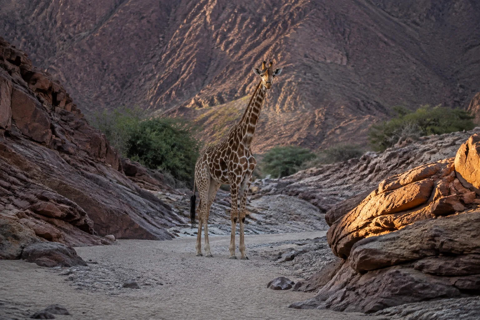
Across the combined Loisaba–Mpala landscape, the model mostly allowed movement to spread across many alternatives. It found no single prominent pathway linking the whole area. Within Loisaba, the finer analysis predicted more concentrated passages where suitable vegetation lay beside steep changes in terrain, particularly in the central and southern parts of the conservancy.
Some of the recorded giraffe tracks repeatedly passed through these areas. That overlap helps connect the map with real journeys, but the same tracking record helped build the model. Observations from other animals or later periods would provide a stronger check on which predicted passages remain important. The two analyses also used different vegetation information, so their contrast reflects map detail as well as geographic scale.
The practical implication is specific. Land-use planning could examine whether a proposed change would interrupt a frequently used passage with few alternatives. Where several alternatives remain, retaining that wider room to move may help giraffes continue reaching resources as conditions change.
Why were the giraffes near roads?
At both scales, the animals moved closer to roads than the sampled alternatives. Within Loisaba, roads also ran through moderately covered habitat with browse and water features. The result raises a question about what makes those surroundings attractive.
The authors suggest that visibility beside roads could matter, or that the road network simply overlaps good habitat. Tracking alone cannot separate these explanations. Comparing feeding, vigilance and movement beside roads with different traffic levels would help determine whether the association persists when the habitat is similar. This matters for management because a road through useful habitat may also become a source of disturbance as traffic changes.
From two conservancies to a wider network
Ramiro Crego and colleagues’ 2021 Laikipia study considered a larger mosaic of land uses. It combined aerial-survey estimates of where herbivores occurred with mapped fences and other barriers. Giraffe, elephant and zebra models identified broadly similar connections, suggesting that some landscape links could serve several large herbivores.
The team checked their estimates of movement difficulty against tracking data. The three tracked giraffes used areas assigned lower resistance than simulated paths. This supported the approach within a small validation sample. Boudreaux’s later work adds seasonal habitat choices and finer terrain detail to the same regional question: connections between conservancies also depend on what an animal encounters inside them.
A different comparison helps explain why maps still need to be tested against the kind of journey they are intended to protect. Meredith McClure, Andrew Hansen and Robert Inman compared connectivity models with elk migration and wolverine dispersal. Circuit models performed better for the wolverines; a model favouring efficient routes held only a weak, inconsistent advantage for elk. The authors suggest that travel along familiar seasonal routes can differ from movement through unfamiliar country. For giraffes, routine journeys between feeding patches and a young animal leaving its usual range deserve separate examination.
Which journeys should researchers follow next?
Do other giraffes use the predicted passages? New tracking or repeated observations, kept separate from the data used to fit the model, could compare use of concentrated passages with the wider areas offering several alternatives. Recording season and vegetation change would help distinguish a lasting connection from a short-lived response to food.
Does the same habitat work for mothers and young animals? The focal analysis pooled movements instead of separating age, sex and group composition. The authors identify these differences as a useful next step. Pairing tracking with observations of calves and group membership could reveal whether visibility, cover and browse matter differently for different animals.
Boudreaux and colleagues have made these questions more precise by turning individual journeys into an account of usable habitat and possible connections. The next observations can test where that account holds—and help keep feeding places within reach. The fragmentation research collection follows this problem across other giraffe landscapes.
Sources
- Shannon Boudreaux, Jenna Stacy-Dawes, Arthur B. Muneza, Jared A. Stabach, Julian Fennessy, Michael B. Brown, Symon Maisiane and Shifra Z. Goldenberg (2026). Reticulated Giraffe habitat use and connectivity across conservancies in Laikipia county, Kenya. Landscape Ecology 41, article 147. DOI: 10.1007/s10980-026-02387-y. Published online 15 June 2026.
- Ramiro D. Crego, Harry B. M. Wells, Kimani S. Ndung’u, Lauren Evans, Redempta Njeri Nduguta, Muthiuru A. Chege, Michael B. Brown, Joseph O. Ogutu, Gordon O. Ojwang, Julian Fennessy, David O’Connor, Jenna Stacy-Dawes, Daniel I. Rubenstein, Dino J. Martins, Peter Leimgruber and Jared A. Stabach (2021). Moving through the mosaic: identifying critical linkage zones for large herbivores across a multiple-use African landscape. Landscape Ecology 36, 1325–1340. DOI: 10.1007/s10980-021-01232-8; author-hosted full paper.
- Meredith L. McClure, Andrew J. Hansen and Robert M. Inman (2016). Connecting models to movements: testing connectivity model predictions against empirical migration and dispersal data. Landscape Ecology 31, 1419–1432. DOI: 10.1007/s10980-016-0347-0; author-hosted paper.